THE BOOK
Some of the ideas discussed in this blog are published in my new book called "The Stonehenge Bluestones" -- available by post and through good bookshops everywhere. Bad bookshops might not have it....
To order, click
HERE

Thursday 25 April 2024

The Great Cursus -- the place where the stones were found?


The Cursus in context (courtesy National Trust)

As readers of this blog will know, I'm not a great one for speculations. I spend a lot of my time criticising fantasies and speculations, and people who dress up speculations as the truth.   

But every now and then, a spot of speculation can be fun, and in reading up a bit on the Great Cursus, it seems to me that nobody has ever suggested that it might have been the place where stones were found, or the place from which stones were collected for the building of Stonehenge.  They must have come from somewhere..........

Sounds crazy?  Well, maybe, and my money is still on it being a sort of processional feature, along which people walked for some ceremonial or ritual (ie non-economic or "irrational") purpose currently unknown.  It's a better hypothesis than the Roman race track or the spacecraft landing strip hypotheses........ and I'm not all that convinced by the ideas that the enclosed strip was either sacred or cursed, or that it was deliberately enigmatic, built by people for whom the act of building was all that mattered.  Built for symbolically keeping things in, or keeping them out?  Or was it not an enclosure at all, but a line between a landscape devoted to the living, on one side, and a landscape devoted to the dead, on the other.  Or maybe a line between a ceremonial landscape and a "normal" landscape where people just got on with their lives?  Or maybe it has an "astronomical" origin, aligned as it is towards the horizon sunrise on the equinox? 

I don't like the line idea, because there are two slight embankments, more or less parallel to one another.  If the Neolithic builders had wanted to demarcate a boundary or a frontier, surely they would have been happy with one embankment, maybe made even higher and more prominent?

And the processional idea is also somewhat strange, because the ends of the 3 km routeway are closed off -- so there is no entrance and no exit.  Which way would people have walked?  Westwards or eastwards?  Probably westwards, because near the western end there is a cluster of barrows and other features -- but the round barrows are considerably younger than the Cursus embankment, and so they could not have been involved in any funerary processions heading towards the sunset. On the other hand, the long barrow called Amesbury 42 is close to the eastern end, and so maybe they walked towards that........  and that one has the advantage of being more or less the right age.   

It's intriguing that the Cursus seems to be unrelated to the landscape in that it drops down across the chalklands into Stonehenge Bottom valley and up again on the other side, so topography does not seem to have determined its location.

So is there anything that might point us towards the Cursus as having something to do with stones -- either bluestones or sarsens?  Or both?  Well, it may or may not be significant that there are abundant records of bluestone "fragments" being found in association with the Cursus -- especially at the western (Fargo Plantation) end. The finds are mostly from field walking collections; there are only two recorded excavations running across the whole width of the Cursus, one in 1917 and the other in 1959. The other excavations have been on the embankments -- mostly concentrating on the search for materials (such as antler picks) that might permit radiocarbon dating.

The researcher who seems to have been most intrigued by the Cursus was Jack Stone in 1949 -- according to some sources  he cut a trench across the Cursus and was so impressed by the concentrations of bluestone fragments near Fargo Plantation and between the Cursus and the site of Stonehenge that he thought there might have been a "bluestone monument" at the former site that was dismantled, modified and then reconstructed in the monument we see today. If bluestones were at one time scattered across the landscape as an erratic trail or train aligned with the direction of ice movement, and then collected and used as building materials, we might expect to find occasional extraction pits or hollows, and maybe patches of degraded till.  No such things are known -- although it has to be said that nobody has ever looked for them.

And if this ever was a "collecting ground" for bluestone erratic boulders, slabs and pillars, the tract of country involved might have acquired sufficient ceremonial or sacred status to justify marking it out with the embankments that we can still -- with difficulty -- see today.

This is just a suggestion, and I am not at all sure how seriously to take it. But remember -- you saw it here first.............


The Cursus, seen from the Fargo Plantation end


Wednesday 24 April 2024

Our ancestors were not as stupid as you might think........

All hail the bluestone route to Stonehenge.  Used in an article demanding greater respect for the intelligence of Neolithic tribesmen -- a nonsense illustration clearly created by artificial intelligence.  Or maybe by artificial stupidity.
How ironic is that?

This is quite wonderful.  Our old friend Tim Daw, over on his Sarsen.org blog site, is fighting the corner on behalf of our heroic ancestors, and accusing people like me of a lack of respect for their intelligence.   He reproduces a press release (presumably from EH at Stonehenge, or from Cardiff University) in which Win Scutt accuses sceptics of the human transport thesis of "insulting our Neolithic ancestors" and urging us to have a greater appreciation of their capabilities.

Not for the first time, Tim completely misunderstands the situation. I have the greatest respect for the intelligence of our Neolithic ancestors, and I should have thought this is pretty obvious to anybody who reads this blog as avidly as Tim does. 

After all, they had aspirations to build Stonehenge, and even if they never managed to finish it because they ran out of stones, they did at least try. They moved a lot of rather large monoliths at Stonehenge, Avebury and elsewhere, and used some rather smart building techniques. They shaped some of the stones into rather elegant pillars. They may even have been smart observers of the movement of the sun, the moon and the stars in the sky. But to suggest that they were stupid enough to try and transport 80 big bluestone boulders and slabs all the way from Preseli to Stonehenge, across savage terrain, and then shaped some of them into pillars, thereby reducing their bulk and weight by maybe 50%, is a real insult to their intelligence. I think they did what any smart group of individuals would have done when they saw an opportunity to use relatively abundant stone resources on the rolling chalklands of Salisbury Plain. They decided to build a highly imaginative structure more or less where the stones were found. That was truly exceptional. 

They were smart enough to know all about cost / benefit analysis, and carried on with the work for as long as they had available stones. They had to go further and further afield to find the stones that they needed, but as they did so their costs (in manpower and effort) increased inexorably, and the benefits diminished. At last, when the costs far outweighed the benefits, and with only about 50% of the desired stones in place, they experimented with various stone settings, decided that none of them were exactly what they wanted, and eventually gave up on the whole thing. Just as any other group of intelligent human beings would have done, they went off and did something else which involved less effort and which brought them more pleasure.......... maybe an orgy or two over at Durrington village........

So three cheers for our Neolithic ancestors. May they continue to thrive!!

===============================

Here is the press release:

Doubting the overland transportation of the stones is insulting to our Neolithic ancestors.

Professor Keith Ray, a university professor and archaeologist, embarked on an extraordinary journey—a 222-mile trek through the Welsh and English countryside. His mission? To reach the iconic Stonehenge on schedule. But this wasn’t just a leisurely stroll; it was a quest to trace one of the possible routes that Neolithic peoples might have used to transport the massive megaliths from the Preseli Hills in Wales to the Salisbury Plain.

On Sunday, April 21, Professor Keith Ray achieved his goal, arriving at Stonehenge. Along different sections of his walk, he was joined by numerous academics, archaeologists, and other experts who accompanied him to learn about the terrain first hand. The journey took less than a month, and it provided valuable insights into the ancient landscape.

Win Scutt, senior properties curator for English Heritage, labeled Keith’s trip an “absolutely astonishing, heroic achievement”. At the seminar about the trip it was emphasized that doubting the overland transportation of the stones was insulting to our Neolithic ancestors and researchers were urged to have appreciation for their capabilities.

Keith Ray’s low-tech research method led to an interesting discovery: a route through the hills and mountains between Wales and England that never required more than a 20-degree climb. Along the way, he was joined by over 20 other academics. Keith observed that the lines of travel often followed ancient paths, demonstrating how the ancients navigated the landscape by going with the land and following the path of least resistance.

Kate Churchill, an archaeologist at Churchill Archaeology in Monmouthshire, walked part of the way with Keith. She found the experience comparable to walking during Neolithic times, allowing her to “stop and look at the landscape and be inspired.”

Professor Keith Ray’s remarkable journey sheds light on the historical connections between Wales and Stonehenge, revealing the ancient pathways that once connected these distant lands.

(Press release via Microsoft CoPilot)

==============

In the Salisbury Journal, we see the following: Win Scutt, senior properties curator (west) for English Heritage, who labelled Keith’s trip an “absolutely astonishing, heroic achievement”, said it was insulting, in light of all the evidence, for academics to still doubt the stones’ overland transportation.

Er, excuse me, but "in light of all the evidence" ???  ........and what evidence might that be?  Does Win know something that the rest of us don't?

Bluestone lithics from the Stonehenge landscape


Lots of sockets and lots of stones -- from the Darvill / Wainwright 2008  dig at Stonehenge.  The packing stones on the left are probably all sarsens, but there is a lot else going on here.

Thanks to Tony for a number of comments recently about the bluestone lithics in the Stonehenge landscape.  There are -- by common consent -- thousands of them, dug up and revealed in Stonehenge digs, in field walking exercises, and in excavations elsewhere in the Stonehenge landscape.  Most of them are ignored or thrown away, and Ixer and Bevins choose not to take them seriously unless they are clearly related to known bluestone orthostats -- so that neatly eliminates anything "inconvenient"............

See Julian Richards, 1990 -- The Stonehenge Environs Project, EH, London

https://archaeologydataservice.ac.uk/archiveDS/archiveDownload?t=arch-1416-1/dissemination/pdf/9781848022096_ALL_72.pdf

But it isn't that easy. Stone and Richards, in various publications, refer to a "wide distribution" of fragments of dolerite, rhyolite and volcanic ash, and they refer to many rock types that are not represented in the bluestone orthostat assemblage.  They refer to "unknown" rhyolites, ashes, dolerites and quartzites.  Mostly they label the bluestone finds as flakes, fragments, slabs, hammerstones or tools -- demonstrating an unwillingness to contemplate the presence of bluestone boulders, cobbles or pebbles that might have nothing to do with human activity.

And the things that are all too easily referred to as "tools" may indeed not be tools at all, but perfectly natural small bluestone erratics such as we might find in any degraded glacial deposit:

Here is another old photo from a 1902 excavation at Stonehenge, again assumed to show "sarsen stone and flint implements" -- with no apparent awareness that some might simply be glacial erratics......

https://www.silentearth.org/restorations-at-stonehenge-2/


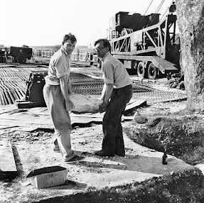
In the photographic record of the Atkinson and earlier digs at Stonehenge, over and again we see packing stones and small boulders that are simply ignored and thrown onto spoil heaps.  Appalling!  Watch this space.........


Atkinson helping to remove a packing stone
See also:

P 15.  In the centre we found a shaft. Atkinson must have skimmed the edge of it in 1964, but most of it lies within our trench. It is about 1.1m deep and has a very homogenous fill. Right in the top there was a very fine block of bluestone, which Rob Ixer has provisionally identified as a piece of very fine-grained siltstone or sandstone; geologically speaking, this can be paralleled by a piece found in the cursus by J F S Stone some years ago. So we have an interesting circulation of bluestone fragments; this is a substantial piece and all around it is a scattering of flakes and smaller pieces, which have been broken off.

https://eprints.bournemouth.ac.uk/11797/1/Darvill_and_Wainwright_2009_Stonehenge_Excavations_2008.pdf

The Antiquaries Journal, 89, 2009, pp 1–19  The Society of Antiquaries of London, 2009 doi:10.1017⁄s000358150900002x. 
First published online 21 April 2009

STONEHENGE EXCAVATIONS 2008 Timothy Darvill, VPSA, and Geoffrey Wainwright, PSA


Tuesday 23 April 2024

The new Holocene article


It's one month since publication, and this is the link to my article in The Holocene journal:

https://journals.sagepub.com/doi/10.1177/09596836241236318

https://doi.org/10.1177/09596836241236318

It's flagged up as open access, but as we all know, that does not mean access to all who may wish to read it.  If you can't get at it on the journal web site, it is also here on Researchgate:

https://www.researchgate.net/publication/379121966_The_Stonehenge_bluestones_did_not_come_from_Waun_Mawn_in_West_Wales

This is the final accepted version in the format I submitted -- so it appears slightly different from the version published in the journal.  But it's all there......... and has over 2,600 reads so far, so people are taking it seriously.

If you want a PDF of the article as published, let me know, and I will get a copy off to you. I am allowed by the publishers to distribute copies to friends and fellow researchers for their personal edification!

Ref:
John, B.S. 2024. The Stonehenge bluestones did not come from Waun Mawn in West Wales. The Holocene, March 20, 2024 (published online) 13 pp.


Sunday 21 April 2024

Hooray for the invisible stone carriers!


Just when you thought it couldn't get any more bonkers, it did............


From the Stonehenge facebook page:

Today, English Heritage Senior Properties Curator, Win Scutt joined part of a 230-mile walk of one possible route for the transport of bluestones from the Preseli Hills to Stonehenge.

The Stonehenge bluestones made an epic journey to get here and how they were transported from Wales during the Neolithic period remains one of the greatest mysteries.

Professor Keith Ray designed the long-distance route and is walking its length on consecutive days, to explore the landscape through the eyes of Neolithic people and visualise how the land may have looked over 5,000 years ago. Those taking part in the experimental walk have reflected on the choices and challenges which the stone-carriers may have faced if they had travelled along the same route.
It’s thought that this is the first time that the journey has been made on foot in modern times.

From the BBC report:

Professor Ray said he wanted to draw attention to these scientific discoveries and it was also important to consider the "whole question of Neolithic journeying and its purposes".

"I would say Neolithic people were very aware of significant communities and that's how they organized it so that they could follow a route linking with particular communities."

Heather Sebire, senior properties curator at English Heritage said: "We've never known exactly how the stones were brought from so many miles away to this ancient landscape 5,000 years ago.

"Professor Ray's endeavours will help keep the discussion around this fresh in the minds of archaeologists and the public.

==============


The Millennium Stone pull in the year 2000.  A shambles, even with abundant manpower, asphalt roads, modern ropes, low friction netting, heavy lift cranes and standby JCBs..........  How much more evidence do you need before you get the message that the whole idea of overland monolith transport was and is ludicrous?

So what about the Millennium Stone fiasco?  To this day, that is the only serious piece of experimental archaeology ever done that took die account of terrain, weather, available technology etc.  Conveniently forgotten by the Stonehenge management......

Well, I hope that Prof Ray enjoyed the walk and feels all the better for having done it.  But the EH staff should be ashamed of themselves, propagating a myth that they know is unsupported by hard evidence and which is seriously challenged by others, including myself.   It's all about marketing, and all about money.   As long as the Stonehenge cash registers keep on jangling, who cares about the truth?  


Friday 19 April 2024

Another computer model


There is a new and rather spectacular computer generated interactive and animated "icemap" showing the expansion and contraction of the BIIS and the SIS during the Late Devensian. It's free for anybody to use, and it has been created by Henry Patton at Tromsø University in Norway.

https://icemap.rhewlif.xyz/?fbclid=IwZXh0bgNhZW0CMTAAAR3Q2Wsw4JAYdL_lyda1ajOdLQNbtwJ8iePNU34H-v__H4qAlL_yK383hTU_aem_ASWAPezhTzxON2vIelI668jcP7phW4y9poLVfj70C2jDTe9HnYeSPFfM1VL010AJ1AuLrKH2LHk726z2Byo50Qfa#

It's visually very attractive and seems to me to be pretty reliable for the most part. However, there is a major issue with dating, and the peak of the LGM is shown here as around 22,500 yrs BP as compared with around 26,000 yrs BP in the BRITICE reconstruction. Who is correct? This is a very substantial difference, no doubt explained by differences in the calibration of radiocarbon and marine isotope dating........

Also, Henry seems to have been using different databases for different parts of this computer programming exercise. On the ice extent map, the Devensian ice edge is shown hitting Salisbury Plain. That will cause quite a lot of discussion, since the BRITICE reconstruction is far different -- and with most researchers suggesting that the inner part of the Bristol Channel was not affected by glacier ice during the LGM, but that ice extent was greater during earlier glacial episodes.

Also, on the map showing actual LGM ice limits, the line used by Henry is very unreliable, being based on an acceptance of the "ice free corridor" in central and south Pembrokeshire -- which I demonstrated as being unreliable theoretically and in practice, in my 2023 QN article.

But all in all a very worthwhile and attractive teaching aid which will fascinate a new generation of budding glaciologists!


The LGM maximum line as shown on the new model.  The representation of the Bristol Channel as being effectively ice-free does not stand up to scrutiny.

The Lost Circle -- British Open Brass Band Challenge!!


You couldn't make this up. "The Lost Circle" has now been set to music by Belgian composer Jan Van Der Roost as a test piece for the British Open Brass Band competition.


https://www.4barsrest.com/news/60636/british-open-announces-2024-test-piece

This is hilarious on one sense. But it is also a stark reminder of the manner in which wild speculations and dodgy science can turn fantasies into myths and in turn into something seen by others (such as Belgian brass band composers) as established truth. The commissioning sponsors have clearly all been swept up in the media frenzy about Waun Mawn, and probably just loved that famous TV documentary fronted by Alice Roberts.  One cannot doubt that in good faith our friend Jan the Composer has accepted that the "Lost Circle" at Waun Mawn did actually exist -- before going on to explore musically what the "how and why" might have been.

So are MPP and his merry men feeling guilty about misleading gullible members of the public so comprehensively? I doubt that very much...........

===================

Here is the blurb:

British Open announces 2024 test-piece

'The Lost Circle' by Jan Van Der Roost will pose questioning musical challenges for bands wishing to construct a British Open winning performance at Symphony Hall this year.

The composer explored both why and how the Bluestones of Stonehenge came to their final resting place

A new commission by the critically acclaimed Belgian composer Jan Van Der Roost has been announced as the set-work for the 2024 British Open Championship.

'The Lost Circle' is his fifth major contest composition and has been commissioned through an international consortium of organisations, including the British Open alongside the national bodies of Belgium, The Netherlands, Norway, Switzerland, Germany and Austria.

It will receive its world premiere at the 170th British Open Championship at Symphony Hall, Birmingham on Saturday 7th September.

The work sees the composer return in inspiration to Stonehenge — the ancient site on Salisbury Plain in the UK that has held fascination to humans for millennia. It is, as the composer says, "a monument that has been the subject of questions, guesswork, doubts and speculations from time immemorial."

However, although 'The Lost Circle' is linked thematically in musical inspiration, it is not an "explicit successor" to his earlier 'Stonehenge' composition written in 1992.

Instead, as Jan Van Der Roost writes in his foreword to the 16-minute score, it is a work rich in thematic symbolism. It questions both how and why the inner circle of megalithic Bluestones were brought by ancient people on a 240-kilometre journey from deep in the Preseli hills in West Wales to their final resting place.

Speaking exclusively to 4BR he said: "I am honoured to write 'The Lost Circle' for the British Open and the national associations of Belgium, The Netherlands, Norway, Switzerland, Germany and Austria where it will subsequently be performed at their National Championships.

It follows 'Excalibur', 'Stonehenge', 'Albion' and 'From Ancient Times' in being used at major events, and I will be delighted to hear it performed at the magnificent Symphony Hall in Birmingham for its world premiere."

He added: "It is definitely a challenging and demanding work, but one I hope will be enjoyed by the conductors, performers and audiences alike in the months to come in the UK and Europe."

In making the initial contest announcement, British Open Championship Artistic Advisor, Dr Robert Childs told 4BR: "Jan Van der Roost is rightly regarded as one of the foremost composers writing for the brass band medium.

'The Lost Circle' is a magnificent work — and one which I am sure alongside our colleagues throughout Europe will provide a wonderful musical test for competing bands, and a thoroughly rewarding musical experience for listeners."

British Open Contest organisers Martin and Karyn Mortimer added: "It will be the first time Jan Van Der Roost has written a work to be used at the British Open Championship. We are thrilled to be able to provide the stage for its world premiere. Our thanks got to him and to our consortium friends for making this wonderful piece possible."