THE BOOK
Some of the ideas discussed in this blog are published in my new book called "The Stonehenge Bluestones" -- available by post and through good bookshops everywhere. Bad bookshops might not have it....
To order, click
HERE

Monday 23 December 2013

Chips off the old block


The main sites referred to in the latest paper -- mostly debitage sites

"Chips off the old block: the Stonehenge debitage Dilemma", by Rob Ixer and Richard Bevins, Archaeology in Wales 52 (2013), pp 11-22
https://www.academia.edu/5464937/Chips_off_the_old_block_The_debitage_Dilemma

Another new paper from the "provenance hunters" Rob Ixer and Richard Bevins -- this time published in "Archaeology in Wales". To quote the authors at the outset:

Within this century there has been a renewed interest in the lithology of the Stonehenge bluestones, both for the standing orthostats and also for the vast numbers of broken bluestone material, now referred to as debitage. Increasingly it has been recognised that there are a number of interesting problems associated with this debitage found within the ‘Stonehenge Landscape’, most notably their original geographical provenance, their internal Stonehenge provenance (matching debitage to parent orthostat), the reason for their presence and finally explanations for the apparent mismatch between the lithologies of the (above-ground) bluestone orthostats and the debitage both in terms of type and numbers. A fundamental initial step in answering most of these questions is to try to match debitage fragments from well constrained contexts to their parent orthostat.

So the debitage (c 4000 rock fragments and c 100 thin sections examined) is the focus here.

The authors also state, with respect to origins:

In relation to the explanation for the debitage, amongst the main anthropogenic contenders are the following: (a) that it is wastage from the dressing of the orthostats, (b) that it is true debitage associated with the later reuse of the orthostats as ‘quarries’ for axe manufacture, (c) that it is made up of ‘knock-offs’ from later souvenir hunters or amulet collectors. The favoured non-anthropogenic explanation is that some of it comes from (glacial) erratic background material, some of which was not incorporated into the Stonehenge stone settings (John, 2008). Of course, it is quite possible that all of these explanations are partly correct; they are not mutually exclusive.

With resepect to the main Stonehenge bluestone lithologies, they say:

The main bluestone orthostat lithologies are either spotted or non-spotted dolerite (the authors suggest 3 groups -- BJ) but within the outer bluestone circle there are 12 non-dolerite bluestones (used here in the sense of any non-sarsen, proven or potential, Stonehenge orthostat material), including both standing orthostats (SH38, 40, 46 and 48) and buried stumps (32c, 32e, 33e, 33f, 40c, 40g, 41d, 42c) (Atkinson, 1979). Of these, 32e is described as a rhyolite, 40c as a calcareous ash, 40g and 42c as micaceous sandstones and 32c, 33e, 33f and 41d as altered, dark olive-green ash (Atkinson, 1979; Thorpe et al 1991). In addition the Altar Stone is a calcareous sandstone of probable Devonian age and unlike any other lithic from Stonehenge (Ixer and Turner, 2006). 

The bluestone debitage comprises spotted and non-spotted dolerite, a restricted set of rhyolite and rhyolitic tuffs, informally known as ‘rhyolite with fabric’ and more formally as Rhyolite Groups A –E (Ixer and Bevins, 2011b), a variety of argillaceous and calcareous tuffs (informally known as ‘volcanics with sub-planar texture’), and a numerically far smaller group of sandstones including (Lower) ‘Palaeozoic sandstone’ and ‘micaceous sandstone’. Other non-bluestone lithologies are very rare and mainly restricted to disturbed or modern contexts and are not discussed further. 

The authors are circumspect, but from previous work there appear to be at least 15 different lithologies in the frame.  There appear to be nine different rhyolites -- represented in the orthostats and in the debitage.  The Altar Stone (Devonian sandstone) is unique among the orthostats, and there are just 3 debitage fragments that appear to match it.  All the other sandstone debitage fragments are from other sandstones -- probably Lower Palaeozoic, and possibly from North Pembrokeshire........

Rhyolite orthostats 38, 40 and 46 appear to be different, and unusual in that there appears to be no debitage related to them.  Orthostat 48 (made of Group E rhyolite) does have some debitage related to it.  There are abundant fragments of debitage in Rhyolite Groups A-C -- assumed to have come from Craig Rhosyfelin, but as yet no related orthostat has been found.  The authors speculate in this paper, not for the first time, that there may be a match either in stump 32d or 32e.

The conclusion of the paper is as follows:

Although the evidence is very incomplete the hypothesis is, that, for the non-dolerite bluestones, above-ground orthostats have no debitage and so have suffered little systematic removal of material, (the recent observation by Abbott and Anderson-Whymark (2012, 25) that the bluestone circle bluestones are largely undressed partially supports this suggestion) whereas the most abundant classes of debitage belong to (now buried) ‘slighted’ orthostats and are the result of a purposeful destruction possibly by those with an axe to grind. But here is the rub; most of the ‘slighted’ orthostats comprise ashes, tuffs (‘volcanics with sub-planar texture’) and sandstones, ‘soft’ lithologies that would be difficult to work into tools. These proposals can, should and will be further tested.

As for the future, the authors say:

Sampling that would provide longer term provenancing data should begin with buried orthostats SH40g and SH42c, noted by Atkinson as micaceous sandstone. This would allow comparison of these two orthostats with the Altar Stone and with the (Lower) ‘Palaeozoic sandstone’ debitage to determine if either is the parent for any of the sandstone debitage. This should then be followed by sampling buried orthostats 32c, 33e, 33f and 41d, noted by Atkinson as altered, dark olive-green ash. This would allow comparison of these with two or more classes of ‘volcanic with sub-planar texture’ debitage, again to establish any relationship. Finally, sampling the remaining standing and buried dolerite orthostats would allow for new petrographical and geochemical analyses to complement the on-going programme of sampling in situ Preseli sources.

All in all, another interesting piece of work, confirming the very large number of lithologies represented among the bluestone orthostats and the bluestone debitage, and confirming the point that much of the debitage has not apparently come from the dressing of stones still present in the bluestone settings.  Quite reasonably, the authors therefore suggest that many stones might have been completely smashed up, and that the debitage comes largely from those.  I would have liked more discussion of non-anthropogenic origins for the debitage -- maybe we would have had it if the paper had been submitted to a geological journal instead of an archaeological one.  From where I stand, I still see an assemblage of erratic materials that have come largely from West wales.  I also see considerable areas of the Stonehenge landscape that have not yet been excavated -- and I assume that new and undiscovered rock types may well be represented in these areas.  The number of lithologies represented in the Stonehenge landscape seems to be going up all the time, and there is a lot of provenancing still to be done.  And EH must get up off its backside and accept that if some of the major problems surrounding the bluestones ever are going to be answered, there MUST be a proper sampling programme on the bluestone orthostats themselves.  ALL OF THEM!

Saturday 21 December 2013

MPP's lunchtime lecture


This is one of the slides Prof MPP used in his lecture.  He claimed that the provenance of one of the rhyolite monoliths at Stonehenge had been fixed to an accuracy of 1 m by Richard Bevins and Rob Ixer, and he claimed that the white dot on the photo shows a recess from which the stone came.  Well, I see a fissure, that's for sure -- but I am afraid I see no recess from which a 2-tonne or 4-tonne monolith might have been taken.  Neither do I accept, from the evidence presented, that the foliated rhyolite fragments in the debitage at Stonehenge have been provenanced with that level of accuracy.

Prof MPP's lunchtime lecture at UCL was put onto YouTube on 10th December.  Here is the link:

Unravelling the mysteries of Stonehenge 

http://www.youtube.com/watch?v=81owUAZJ4Qk

All credit to him for covering a lot of territory in about 30 mins.  Not a lot in the talk that was new -- and MPP employed his usual technique of making it appear that all sorts of things are self-evident when in reality they are highly contentious.  Thus it was presented as self-evident that Stonehenge was a "place for the ancestors"; that Durrington Walls contained the settlement camp for the builders of Stonehenge; that the bluestones were in the Aubrey Holes before they were taken and used in other settings; that the so-called "periglacial fissures" determined the alignment of the Avenue and the precise positioning of the stone monument; that Neolithic monuments were preferentially built in concordance with natural features or astronomical alignments;  that if there was a religion in the Neolithic it was a "religion of place"; that Craig Rhosyfelin was the site of a Neolithic bluestone quarry; and that the catchment of the River Nevern was so special that it encouraged the collecting of monoliths for the building of a revered stone circle at Castell Mawr which was then transported lock stock and barrel to Stonehenge shortly after 5,000 years ago.  All of those things are worthy of debate -- but MPP is a man who likes to decide what his story is on the basis of very thin evidence indeed.

That all having been said, there were a few interesting snippets in the talk:

1.   A very comprehensive set of data from the teeth and bones of animals in the Durrington Walls "barbeque middens" (more than 70 samples) suggests that the animals (mostly cattle and pigs) came from all over the UK -- including Scotland, Cornwall and the Midlands -- but not from Pembrokeshire.  Prof MPP made one rather spurious connection between one pig tooth and South Wales generally, but that was not convincing.  One does need to ask why, if Pembrokeshire was so special that people carted 82 bluestones from there to Stonehenge, there are apparently no animal remains that have come from the same area as the stones?  After all, by this theory hundreds if not thousands of men must have made the journey with the precious stones -- if people travelled with their animals from everywhere else, why did the Pembrokeshire travellers not do the same?

2.  The organic samples from Craig Rhosyfelin which are going to be used for radiocarbon dating were sent off to the laboratory on the very day of the lunchtime lecture.  So they will be available in 2014.  They may tell us if and when there might have been human activity at Rhosyfelin -- but whether they tell us anything about "quarrying activities" is another matter entirely.  Human occupation of the site does not indicate that there was any quarrying going on; in my view it is much more likely that this sheltered location was a favoured camping / hunting site, maybe over many centuries.

3.  It is now apparent, according to the good Prof, that the bluestones were not dragged or rolled or trundled, or even taken by boat, from Castell Mawr to Stonehenge.  They were CARRIED by large groups of men using long poles on either side and a sort of sling holding the stone in the centre.  In answer to a question, MPP said that 50 men -- 25 on each side -- could easily carry a monolith weighing 2 tonnes across country, on the land route that he now favours.  If you have enough replacement gangs to take over when one group tires, there is logistically no problem.  That is apparently all perfectly fine in India, and therefore it is fine in Neolithic Britain as well.

So there we are then.


Thursday 19 December 2013

Mysterious new bluestone site

There is an interesting brief report on Tim Daw's site (thanks, Tim!) about a new site "close to Stonehenge" where spotted dolerite fragments have been found in surface spoil from rabbit burrows.  Here is Tim's note and a link to a photo of what he has found:
 
http://www.sarsen.org/2013/12/bluestone-chips-paper-by-ixer-and.html

"I discovered this surface scatter in the spoil from animal burrows, the black round object is from a rabbit, last summer.  Over two hundred chips have been seen so far on the surface. It is close to Stonehenge, in the landscape but not within the Stonehenge Triangle. I have of course informed the archaeologists at Stonehenge, and can't tell anyone else the location. Sorry."

We await further info when Tim is ready to give it to us.  In the meantime, this is a bit more evidence that there may be quite widespread "bluestone debitage" across the Stonehenge landscape -- and it's worth recalling that there are thousands of acres of terrain that have never been properly investigated for "extraneous" or erratic stones that have arrived, somehow, from somewhere else.

Tuesday 17 December 2013

Miniature bluestone trilithons?

Thanks to Mike Pitts for a fascinating preview of some of the displays to be revealed to the world when the new Stonehenge Visitor centre opens tomorrow.  More photos on Mike's blog:

http://mikepitts.wordpress.com/2013/12/17/the-new-stonehenge-centre/

One thing that caught my eye -- a recreation of one of the early bluestone settings, with a miniature bluestone trilithon in the middle of the picture.  I have often wondered whether some bluestones might have been used as lintels, either supported by other bluestones or as lintels perched on top of the sarsens.  It's good to see that some variations in traditional thinking are beginning to appear.......  the old order breaking down?

Monday 16 December 2013

Search problems

Some followers of this blog might have noticed that there are major problems worldwide just now with the Blogger search box.  Since Google took over Blogger something strange has happened.  Many blogger users have found that their searches don't work at all.  I have tried to install a "workaround" -- but it's not very satisfactory.  When I try to use it myself, it just provides an endless syream of complete blog entries, rather than a list of the blog titles -- which is what it did rather well in the past.

Please be patient -- a lot of bloggers are hassling Blogger -- and I hope they will get the problem fixed before too long.......

Monday 9 December 2013

Bancywarren geology lesson


How about this for a geology lesson?  Faulted fluvioglacial sands and gravels at Bancywarren, north of Cardigan.  These sands and gravels were emplaced during a Devensian ice ADVANCE -- that's a bit counter-intuitive, since big fluvioglacial sequences are normally laid down during ice wastage phases.

The faults are so sharp here that the mass of sand and gravel must have been frozen by permafrost when the faulting took place.  The structures here are very different from those formed by settling / compaction / loading when the mass of fluvioglacial material is in a semi-liquefied state.  So what we have here is an example of a frozen body of sediment which has been subjected to pressure either from the side (eg by an advancing ice front) or by a great weight of ice or other sediments exerting pressure from above.


Thursday 5 December 2013

New two-part TV blockbuster planned for Stonehenge


Oh dear -- I get a sinking feeling...... I wonder who they are talking about here:  "October has gained exclusive access to an international team of scientists conducting an archaeological project at Stonehenge......." ??

BBC, CBC unite for “Stonehenge” co-pro  

Adam Benzine

http://realscreen.com/2013/12/04/wcsfp-13-bbc-cbc-unite-for-stonehenge-copro/

BBC2, France 5, the CBC, Smithsonian Channel, Australia’s ORF and ZDF Germany are among the broadcasters uniting for Stonehenge Empire, a two-part doc looking at Britain’s ancient Stonehenge site.

The 2 x 60-minute production is being made by UK indie October Films with Canada’s Lightship Entertainment and Austria’s Interspot Film.

October has gained exclusive access to an international team of scientists conducting an archaeological project at Stonehenge, and the two-parter will combine new archaeological evidence from the international survey, drama reconstructions and CGI, to produce “the most complete and interconnected picture of the how the whole site looked in its heyday; revealing Stonehenge to be a Neolithic Valley of the Kings,” the indie promises.

The partners unveiled the project at the World Congress of Science and Factual Producers in Montreal today (December 4). It is being executive produced by Adam Bullmore, Terence McKeown and Heinrich Mayer-Moroni.

The series was commissioned by Martin Davidson for BBC2; Sue Dando for CBC; Chris Hoelzl for Smithsonian Channel in the U.S., Perrine Poubeau for France 5; Andrew Solomon for ORF Austria; and Georg Graffe for ZDF Germany. The coproduction was set up by Lilla Hurst at Drive.

In a statement, October creative director Adam Bullmore said: “Stonehenge Empire will dramatically change the way we understand Stonehenge and the prehistoric culture that flourished around it.

“Instead of seeing Stonehenge as an extraordinary achievement of an otherwise relatively primitive, prehistoric people, it will reveal Stonehenge as the epicenter of a truly remarkable and highly sophisticated ancient civilization.”

Davidson, the BBC’s commissioning editor for history and business programming, added: “This is a really exciting project which will, using drama, CGI and the latest archaeological discoveries, allow us to properly understand the achievements and character of the people that built it; people who mastered deep mining, sophisticated engineering, textile manufacturing, ship-building, ‘micro’ gold-working, metallurgy, glass making, overseas trade and complex astronomy and mathematics.”

Read more: http://realscreen.com/2013/12/04/wcsfp-13-bbc-cbc-unite-for-stonehenge-copro/#ixzz2mcasvXRF

Tuesday 3 December 2013

The Sheyenne ice disk -- an amazing wonder!!


A little video has been getting huge numbers of hits on assorted news sites -- showing a slowly rotating disk of ice fragments on the Sheyenne River in North Dakota, USA.    As the enthusiastic reporter keeps on telling us -- it is "an amazing wonder" --or, if you prefer it,  "a wondrous amazement" ...........

It is certainly very strange -- I've never seen anything like it before.  Apparently it's not very big -- just about 50 ft across.  And it rotates very slowly in an anti-clockwise direction.  It's not made of solid ice at all -- it's just an aggregation of small ice fragments which appear to have become trapped in a rotating eddy in the river during very cold freezing conditions.  There are even growth rings on it -- you can see these if you look closely.  Apparently if you throw a stone into the ice disk it just goes straight through and splashes into the water beneath.

Very ephemeral and very freaky.  Not sure how long it lasted.  It's probably gone by now......

Monday 2 December 2013

Force of circumstances


Stonehenge, Pembrokeshire and the Ice Age


Sorry folks, but I'm feeling very groggy at the moment, with one of those nasty flu bugs.  High temperatures, splitting headache and persistent cough --  grrr.

I had two Stonehenge lectures planned -- one for tomorrow (3rd Dec) in Moylgrove Village Hall, and the other for Thursday (5th Dec) in Carmarthen.  I had hoped that things would ease off, but this wretched bug is very persistent, and there is sadly no prospect of me being able to stand up in front of an audience and talking -- rather than coughing -- for an hour or so.  So my wife tells me I am going nowhere for the rest of this week -- and I have to obey orders.....

I hope to be able to rearrange both talks for the coming months.  Watch this space.........

Ding Dong Dolerite.........

The acoustic experiment under way, with all seriousness, at Stonehenge.  Photo -- George Nash.

Amazing revelations from the Daily Mail -- that igneous rocks make a ringing sound when you hit them with a hammer.................... er, no further comment required.  Even Tim Darvill, when plonked in front of a vide camera and asked to make a comment, found it difficult to keep a straight face.  And in case you wondered, no, it isn't April 1st today............
------------------------------

Stonehenge 'was a prehistoric centre for rock music': Stones sound like bells, drums, and gongs when played


    • Rocks make metallic and wooden sounds, in many different notes
    • Monoliths were moved by Stone Age man from Wales to Stonehenge
    • Researchers believe their musical make-up could be why they were moved

By Sarah Griffiths and Amanda Williams

Stonehenge may have been built by Stone Age man as a prehistoric centre for rock music, a new study has claimed.

According to experts from London's Royal College of Art, some of the stones sound like bells, drums, and gongs when they are 'played' - or hit with hammers.

Archaeologists, who have pondered why stone age man transported Bluestones 200 miles from Mynydd Y Preseli in Pembrokshire, South West Wales to Stonehenge, believe this discovery could hold the key.

The 'sonic rocks' could have been specifically picked because of their 'acoustic energy' which means they can make a variety of noises ranging from metallic to wooden sounding, in a number of notes.

Research published today in the Journal of Time & Mind reveals the surprising new role for the Preseli Bluestones which make up the famous monument, and which were sourced from the Pembrokeshire landscape on and around the Carn Menyn ridge, on Mynydd Preseli, South-West Wales.

Bluestones were used in the village of Maenclochog - meaning bell or ringing stones - until the 18th century.

English Heritage allowed archaeologists from Bournemouth and Bristol universities to acoustically test the bluestones at Stonehenge, effectively playing them like a huge xylophone

A significant percentage of the rocks on Carn Menyn produce metallic sounds - like bells, gongs or tin drums - when struck with small hammerstones. Such  sonic or musical rocks are referred to as 'ringing rocks' or 'lithophones'.

The Landscape & Perception project drew upon the comments of the early 'rock gong' pioneer, Bernard Fagg, a one-time curator of the Pitt Rivers Museum, in Oxford.

He suspected there were ringing rocks on or around Preseli and suggested that this was the reason why so many Neolithic monuments exist in the region – with the sounds making the landscape sacred to Stone Age people.

Stonehenge may have been the built by stone age man as a prehistoric centre for rock music, a new study has claimed

English Heritage allowed archaeologists from Bournemouth and Bristol universities to acoustically  test the bluestones at Stonehenge, effectively playing them like a huge xylophone.

To the researchers’ surprise, several were found to make distinctive if muted sounds, with several of the rocks showing evidence of having already been struck.

The stones make different pitched noises in different places and different stones make different noises - ranging from a metallic to a wooden sound.

The investigators believe that this could have been the prime reason behind the otherwise inexplicable transport of these stones nearly 200 miles from Preseli to Salisbury Plain.

There were plentiful local rocks from which Stonehenge could have been built, yet the bluestones were considered special.

The principal investigators for the Landscape & Perception project are Jon Wozencroft and Paul Devereux. Wozencroft is a senior lecturer at the RCA and the founding director of the musical publishing company, Touch.

Jon Wozencroft told MailOnline it was 'amazing' to find that the stones used in the monument make the noises that the researchers hoped for.

'It was a really magical discovery and refreshing to come across a phenomenon you can't explain,' he said.

The researchers have looked into geological reasons as to why some rocks make noise and others do not and one theory is that the amount of silica in the rocks could explain why in the future.

'Walking around Mynydd Y Presel you can't tell which stones will make sounds by sight, but in time you get a sort of intuition by the way they are positioned,' he said.

The researchers had feared the musical magic of the stones at Stonehenge might have been damaged as some of them were set in concrete in the 1950s to try and preserve the monument and  the embedding of the stones damages the reverberation.

Mr Wozencroft said 'you don't get the acoustic bounce' but when he struck the stones gently in the experiment, they did resonate, although some of the sonic potential has been suffocated.

In Wales, where the stones are not embedded or glued in place, he said noises made by the stones when struck can be heard half a mile away.

He theorised that stone age people living in Wales might have used the rocks to communicate with each other over long distances as there are marks on the stones where they have been struck an incredibly long time ago.


Read more: http://www.dailymail.co.uk/sciencetech/article-2515159/Why-Stonehenge-prehistoric-centre-rock-music-Stones-sound-like-bells-drums-gongs-played.html#ixzz2mJb2EmNQ

Monday 25 November 2013

The Rhosyfelin "pedestal" again......


As readers of this blog will recall, I made a series of posts in September relating to the 2013 dig at Rhosyfelin.  One of them related to the idea of a "pedestal" beneath the "monolith that never was taken to Stonehenge":

http://brian-mountainman.blogspot.co.uk/2013/09/the-dreamtime-pedestal.html

Well, this pedestal has come to the fore again.  We have dealt with the railway track, and now we have the pedestal.  One of those who attended MPP's Pembrokeshire lecture the other day reported that he insisted not only that there was a "pedestal beneath the big stone" but that the stones supporting it were once VERTICAL.  Now my informant might have got this wrong, but that suggestion sems to me to be extraordinary.  As far as I can see, there is just a random mess of fractured rockfall debris beneath the big stone -- and no sign at all of any human interference.

Where is this heading?  Are we now going to have a hypothesis of a collapsed portal dolmen here?  Maybe the latest idea is that this big stone was not meant as a standing stone heading for Stonehenge after all, but that it was "chosen" as a capstone for a dolmen or cromlech.  So there we are then -- let's await the denials from those involved in the dig........

And thinking of the 2013 diggers, one small piece of gossip that has reached my ears is that one of the female diggers from the 2013 dig was sent packing on the basis that she asked too many questions and was too sceptical about the MPP interpretation of the site.  If I have that wrong, then no doubt I will be corrected.......... and will apologise for misinformation.

But a little suggestion gnawing away inside my head is the possibility that sycophancy is a necessary qualification for all those involved in the Rhosyfelin dig.  Now surely that can't be true, can it.........???


Stonehenge simulations


Thanks to John Fillwalk for these two images -- from the Idialab web site of Ball State University:
Click to enlarge.

Nice images -- the top one is a reconstruction of the "immaculate Stonehenge" which is still engrained in assorted belief systems, regardless of the fact that we have no evidence that Stonehene ever did look like this......

The bottom one is a recreation of the midsummer solstice sunrise.

It appears that this simulation work will be featured in various History Channel TV programmes still to be shown.
 

Sunday 24 November 2013

Carn Goedog and Stonehenge: the new work


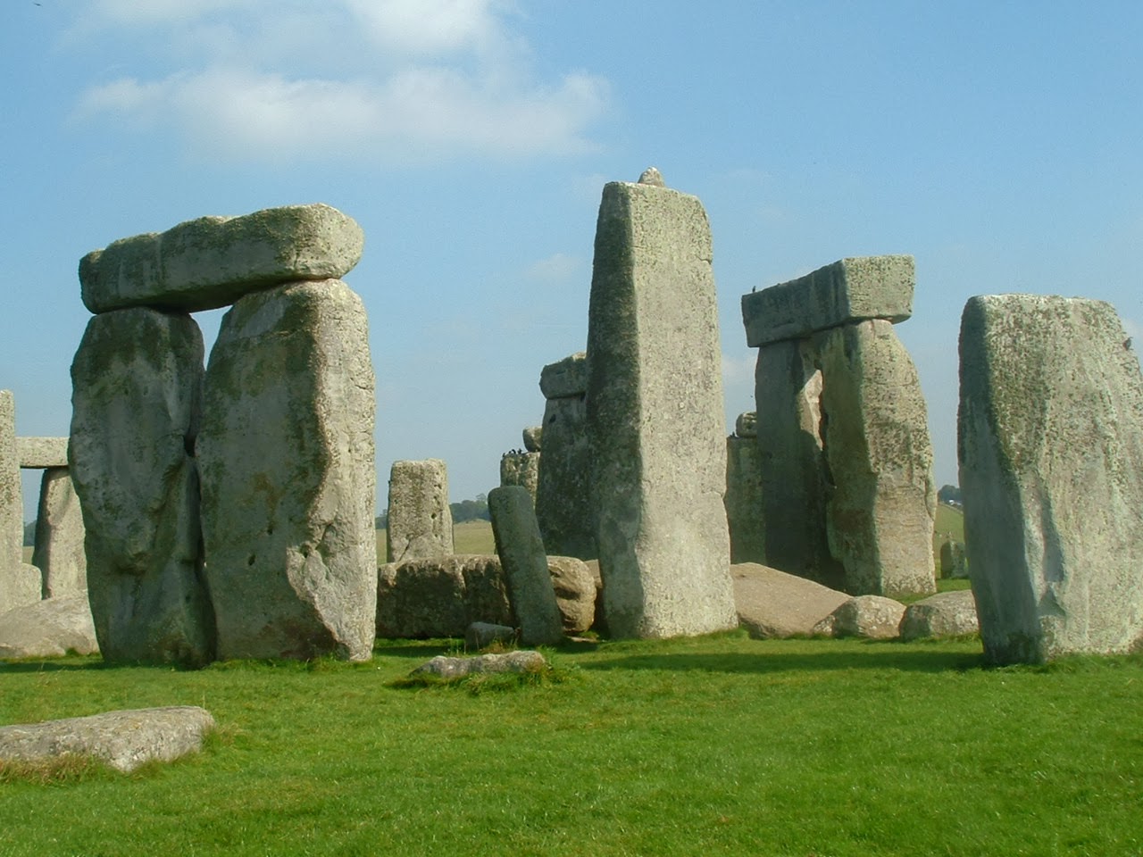
The dolerite outcrops at Carn Goedog, located on quite a steep slope on the northern flank of Preseli.

Map of the dolerite intrusions at the eastern end of Preseli.  The map is still provisional, and will no doubt be refined with further fieldwork.   Key sampling points are shown.

"Carn Goedog is the likely major source of Stonehenge doleritic bluestones: evidence based on compatible element geochemistry and Principal Component Analysis"
Journal of Archaeological Science
Richard E. Bevins, Rob A. Ixer, Nick J.G. Pearce
Journal of Archaeological Science
Available online 19 November 2013
In Press, Accepted Manuscript
http://www.sciencedirect.com/science/article/pii/S0305440313003956#FCANote

Some thoughts on the new paper

This seems to me to be an excellent paper, involving meticulous research and careful presentation of the results.  It is highly sophisticated, and because most of it is really only going to be comprehensible to a small group of igneous petrologists / geochemistry specialists it may not have a very wide readership!  It will be much cited, but seldom read, as is the way with detailed research...........  So let's try to summarise what the main findings are, given the highly simplified nature of the authors' press releases and the banal coverage by the media.

Below I reproduce a few of the key statements from the text.  But the following points are important:

1.  There is no new fieldwork here.  The authors have not been doing any new sampling at Stonehenge, and nor have they been furiously collecting new samples on Mynydd Preseli.

2.  The authors have re-analysed samples already collected over past decades by Richard Bevins and others, and by Olwen Williams-Thorpe and her colleagues prior to the publication of this big report:  Thorpe, R.S., Williams-Thorpe, O., Jenkins, D.G., Watson, J.S., Ixer, R.A., Thomas, R.G.,
1991. The geological sources and transport of the bluestones of Stonehenge, Wiltshire, UK. Proc. Prehist. Soc. 57, 103e157.

3.  A total of 68 samples have been re-analysed using very sophisticated techniques:  22 samples from Stonehenge (from monoliths and debitage) and 46 samples of Preseli dolerite -- spotted and unspotted.  It's worth noting that only 3 of these samples have come from Carn Goedog (which is a very big hillside tor stretching across several hundred metres of terrain.)

4.  It is concluded that 11 (and possibly 12) of the 22 Stonehenge dolerite samples have probably come from the Carn Goedog outcrops. These are called Group 1 samples.

5.  Three of the Stonehenge samples have possibly come from the Cerrigmarchogion area, on the crest of the Preseli ridge and some way to the south-west of Carn Goedog. These are called Group 2 samples.

6.  Five of the Stonehenge samples and the Boles Barrow sample have come from outcrops in the Carn Gyfrwy-Carn Breseb-Carn Alw area (including the un-named outcrop west of Carn Ddafad-las).  These are called Group 3 samples.

7.  One sample from Stonehenge (numbered SH44) has not been assigned to any of the three groups mentioned above.

8.   There is a possibility that Group 1 and Group 3 dolerites might be closely related -- and may ALL have come from the Carn Goedog outcrop.  By the same token, some of them or most of them might have come from some other as yet unsampled part of the same intrusion, which stretches cross-country for about 3 km before being truncated by faults at both ends.

9.  Carn Meini -- for long assumed to be the location of THE bluestone quarry -- does not figure at all in the new provenancing work, and we can see from the detailed mineralogy plots that the Carn Meini samples (around 18 of them?) seem to fall outside the ranges of the three Groups of Stonehenge samples analysed by the authors. 

10.  The dolerite sills in this part of eastern Preseli are highly variable or "geochemically heterogenous."  Also, they have still not been adequately mapped, and whilst there seems to have been quite intensive sampling of the Carn Meini outcrops in the past,  there is still a shortage of samples from the Carn Goedog outcrops.   Expect more surprises when more fieldwork is undertaken!

11.  So has the Carn Meini Quarry now been replaced in the minds of archaeologists by the Carn Goedog Quarry?  If it has, they should think again.  There is a lot of variation in the Stonehenge samples, so even the eleven Group 1 samples have NOT all come from the same precise location.  Overall, we are looking at Carn Goedog rocks that have possibly come from an area several hundred metres across -- and quite possibly some of them have come from outcrops or source areas as yet unsampled.

12.   The 22 Stonehenge samples analysed in this paper have probably come from 22 different locations.  Some of the samples show strong similarities, but each one is unique.  What the geologists have done here is to have narrowed down the provenancing of the sampled Stonehenge dolerites to three or four areas within this landscape of dolerite sills in eastern Preseli -- but there is no way we can talk about point locations or quarries.

13.  When this is all put together with the work that the same authors, and others, have done on the rhyolites and sandstones found in the Stonehenge bluestone and debitage sample assemblage, it still seems to me that we are looking at an assemblage of glacial erratics that have come from many different places -- but preferentially from eastern Preseli -- on the route of the Anglian Irish Sea Glacier.

14.  Remember that there are 43 known bluestones at Stonehenge.  There is also a vast area of debitage at Stonehenge that has not been excavated or sampled.  The authors of this paper look forward to the day when EH will allow ALL of the bluestones to be sampled and analyzed -- and will allow the "unexplored" parts of the Stonehenge regolith also to be sampled.  Expect further surprises -- but maybe not in our lifetimes.........

15.  Many thanks to Rob Ixer for sharing this paper and making it possible for me to conduct this review of the main findings.   He and his fellow authors will will no doubt correct me if I have got anything wrong!!


The 22 Stonehenge samples, with past interpretations / provenancing attempts, and the new provenancing on the right edge of the table. Click to enlarge.

Extracts:

From p 2: 
Bevins et al. (1989) provided an account of the dolerites exposed
in the area between Fishguard and the eastern Mynydd Preseli,
identifying them on field, petrographical and geochemical evidence
as representing a suite of intrusive doleritic sills which were
emplaced at a high crustal level and which are the lateral equivalents
of basaltic lavas (and associated sub-volcanic doleritic sills)
comprising the basic member of the Ordovician age Fishguard
Volcanic Group, the major expression of which is exposed further to
the west (Bevins, 1982). Bevins et al. (1989) suggested that the
basaltic magmas were erupted in a submarine environment in a
graben or half-graben structure centred in the Fishguard to
Strumble Head area, with the magmas being channelled up the
bounding faults. The Preseli district was peripheral to this graben
structure and accordingly the magmas were emplaced as high-level
sills in the adjacent sedimentary sequence.

From p 3: 
In this paper we turn our attention to a re-examination of the
geochemistry of the various spotted and non-spotted dolerites from
the Stonehenge Landscape, including samples from the monoliths
themselves and debitage from various other locations including the
Heelstone Ditch, the Avenue west ditch, Aubrey holes 10 and 22, and
hole Y6. An analysis of a dolerite sample from Boles Barrow is also
included. We review these data, published previously by Thorpe
et al. (1991) but with the addition of one new analysis for monolith
34, and compare them with the eastern Mynydd Preseli dataset
of Bevins et al. (1989) and Thorpe et al. (1991) along with some
previously unpublished analyses by Thorpe and colleagues. In this
re-examination we take a different approach to interpreting the data
from that adopted by Thorpe et al. (1991) and we reach alternative
conclusions. The dataset utilised in this paper comprises analyses of
22 Stonehenge monolith and debitage samples and 46 Preseli
dolerite analyses.

From p 4: 
Thorpe et al. (1991) concluded that they could
determine three different sources, arguing that:
most of the Stonehenge dolerite monoliths (their SH33 Group)
and debitage fragments were derived from a single geographic
source in the eastern part of Mynydd Preseli, either the Carn
Meini-Carn Gyfrwy, or the Cerrigmarchogion or Carn Goedog
outcrops; SH42 is identical (for the immobile elements) to Carn Breseb;
and SH44, SH45 and BB1 are close in composition to dolerite from
Carn Ddafad-las.
However, Ixer (1996, 1997), mainly on the basis of reflected light
microscopy, reached some slightly alternative conclusions for some
of the monoliths, namely that: SH33, 37, 43, 49, 61, 65 and 67 were sourced from ‘Carn
Goedog Carn Meini’;  SH44 and SH45 were sourced from Carn Ddafad-las; and
SH42 was sourced from Carn Breseb (Ixer, 1996), ‘although
petrography suggests Carn Bica or Carn Ddafad-las.’ according to
Ixer (1997).
Finally, Ixer (1997) could provide no satisfactory petrographical
match for sample SH62.
Later, Williams-Thorpe et al. (2006) reported on new PXRF data
for outcrops in the eastern Mynydd Preseli and concluded that Carn
Meini might not in fact be the source of any spotted dolerite artefacts
(and indeed therefore also any of the Stonehenge monoliths)
and noted that the original WDXRF data of Thorpe et al. (1991)
contained ‘clues’ which suggest in fact that the Carn Goedog
outcrop contains dolerites with a composition closer to the main
Stonehenge (SH33) group identified by Thorpe et al. (1991).
What is clear, nevertheless, is that on the basis of hand specimen
and transmitted light microscopy by Thomas (1923), whole rock
geochemistry by Thorpe et al. (1991), and reflected light microscopy
by Ixer (1996, 1997), and new PXRF and magnetic susceptibility
data (Williams-Thorpe et al., 2006) the Stonehenge doleritic
bluestones can be provenanced to the eastern Mynydd Preseli.
What remains to be resolved however is which are the exact source
outcrops and then definitively matching any Stonehenge material
to them.

From p 12: 
On the basis of the above analysis we consider that eleven (and
possibly twelve) samples, representing over half of the Stonehenge
dolerite monolith and debitage samples analysed to date (but
excluding the Boles Barrow sample), can be sourced on the evidence
of compatible element chemistry to the castellated outcrop
of spotted dolerite called Carn Goedog. A further three samples are
possibly sourced to the Cerrigmarchogion-Mynydd-bach area,
more specifically to outcrops at the western end of that line of E-W
trending outcrops, or to Craig Talfynydd. This leaves five Stonehenge
samples and the Boles Barrow sample as coming from outcrops
in the Carn Gyfrwy-Carn Breseb-Carn Alw area (including the
un-named outcrop w of Carn Ddafad-las), with SH44 remaining
unassigned in this study. This result is somewhat surprising as Carn
Meini was considered by Thomas (1923) as the most likely source of
most of the Stonehenge doleritic bluestones (see Darvill et al.,
2008), although he did identify Cerrigmarchogion as another
possible provenance for Stonehenge doleritic bluestones. Our proposal
for Carn Goedog as the principal source ( 55%) of the analysed
Stonehenge doleritic bluestones gives credence to the
suggestion by Williams-Thorpe et al. (2006) that the original
Thorpe et al. (1991) data contained clues indicating that this
outcrop might be the source for many of the Stonehenge bluestones
rather than Carn Meini.

From p 12: 
In summary, we believe we can explain the origin of the three
Stonehenge dolerite groups by petrogenetic modelling involving
crystal fractionation and/or crystal accumulation, processes which
cannot be detected using the incompatible element approach
adopted by Thorpe et al. (1991).

From p 14: 
9. Summary and next steps
On the basis of bivariate plots involving the compatible elements
MgO, Ni, Cr and Fe2O3 this study has identified three
geochemical groupings amongst the Stonehenge monolith and
debitage samples. Differences between these three groups can be
explained in terms of high crustal level igneous processes, namely
crystal fractionation and/or crystal accumulation, affecting a series
of melts derived from a common parental source and can be
determined at the outcrop level in the eastern Mynydd Preseli. Use
of these compatible elements contrasts with the use of incompatible
elements as applied by Thorpe et al. (1991) which are unable to
detect such geochemical differences related to high crustal level
igneous processes in the samples in question.
The bivariate plots suggest that the three Stonehenge dolerite
geochemical groups are derived from three principal geographical
sources, namely Carn Goedog (Group 1), Cerrigmarchogion or
possibly Craig Talfynydd (Group 2) and a set of outcrops including
Carn Breseb, Carn Gyfrwy, those in the vicinity of Carn Alw and the
un-named outcrop immediately west of Carn Ddafad-las (Group 3)
(but note that sample SH44 remains unassigned in this study).
Whilst this agrees in part with the suggestions of Thorpe et al.
(1991) on the basis of whole rock geochemistry and Ixer (1996,
1997) on the evidence of reflected light microscopy the principal
conclusion presented here is that at least 55% of the Stonehenge
monoliths and fragments analysed to date can be sourced to Carn
Goedog. The PCA plots support the association of the Group 1
Stonehenge dolerites with Carn Goedog but also suggest that Group
3 dolerites might come from Carn Goedog, rather than the outcrops
listed above. What seems likely, and is hinted at in some of the
bivariate plots (e.g. Figs.10 and 11), is that the Groups 1 and Group 3
magmas were derived from the same magma batch and that the
difference between Group 1 and Group 3 dolerites relates to
varying mineral concentrations (resulting from crystal fractionation
and/or crystal accumulation) in the samples and that the
compatible element plots highlight this feature. Group 3 samples
might be from an as yet un-sampled part of the Carn Goedog
outcrop, bearing in mind that Jones et al. (2005), on the basis of
PXRF investigations, identified that a number of the eastern Preseli
outcrops were geochemically heterogeneous. Further sampling of
the Carn Goedog intrusion would serve to clarify if this is the case or
not.
Overall, the PCA plots, based on a broader range of elements
(some of which are not compatible in the mafic minerals in the
crystallizing assemblage in the dolerites), serve to support the
conclusions reached on the basis of the compatible bivariate
elemental plots presented here.
Clearly there remain some uncertainties over the exact source of
a small number of Stonehenge dolerite samples and we believe that
generation of a new geochemical dataset, based on ICP-MS techniques,
offers the best way forward to resolve the sources of these
samples. A dataset based on ICP-MS techniques would allow not
only for the generation of analyses for some elements with a precision
and accuracy greater than those derived by WDXRF techniques
but would also allow for additional elements to be added to
the dataset, including for example Sc, Ta, Th, U and the rare earth
elements. These elements would serve to provide further information
about high crustal level igneous processes, such as the role
of clinopyroxene in the crystal fractionation process (by using
Rayleigh fractionation modelling techniques) and also any additional
complicating processes such as crustal contamination of the
melts during magma ascent (by assimilation fractional crystallization
modelling). Some of these elements, not available in the current
dataset, would serve to complement the role that the elements
MgO, Ni, Cr and Fe2O3 have provided in the current study. However,
what is also a pre-requisite is the opportunity to re-analyse well
contexted Stonehenge dolerites, most especially the orthostats.

Saturday 23 November 2013

Carn Goedog spotted dolerite paper


The new paper which is causing so much fun in the media is now online:

"Carn Goedog is the likely major source of Stonehenge doleritic bluestones: evidence based on compatible element geochemistry and Principal Component Analysis"


• Richard E. Bevins
• Rob A. Ixer
• Nick J.G. Pearce

Highlights

•Stonehenge doleritic bluestones were first sourced to Carn Meini and Cerrigmarchogion in west Wales by Thomas in 1923.
•Thorpe et al. in 1991 used incompatible element geochemistry to in part support Thomas’s attribution.
•These attributions have been re-assessed using compatible element geochemistry.
•Nearby Carn Goedog is now clearly identified as the major source of Stonehenge doleritic bluestones.


Abstract

The Stonehenge bluestones were first sourced to outcrops in the high parts of the eastern Mynydd Preseli in SW Wales by H.H. Thomas in the early 1920s. He recognised the distinctive ‘spotted dolerite’ from his fieldwork in that area and suggested that the tors of Carn Meini (also known as Carn Menyn) and Cerrigmarchogion were the most likely sources. In the early 1990s, in a major contribution to our understanding of the Stonehenge bluestones, the geochemistry of a set of samples from Stonehenge monoliths and debitage was determined and compared against the geochemistry of dolerites from the eastern Mynydd Preseli by a team from the Open University led by R.S. Thorpe. They argued that the majority of the Stonehenge dolerites could be sourced from outcrops in the Carn Meini-Carn Gyfrwy area, based on the concentrations of the so-called ‘immobile’ elements (elements which are not affected by rock alteration processes), in particular TiO2, Y, and Zr. However, these elements are incompatible during crystallization of mineral phases in basaltic systems (that is they do not enter into the mineral phases which are crystallizing but are concentrated in the residual liquid) which severely hampers their use in discriminating between different pulses of an evolving magma (as is the case of the doleritic sills emplaced high in the crust and now exposed in the Mynydd Preseli). An alternative strategy in this study re-examines the data set of Thorpe’s team but investigates the concentration of elements which are compatible in such basaltic systems (that is elements which do enter into the crystallizing mineral phases), namely MgO, Ni, Cr and Fe2O3. On the basis of the abundances of these elements on bivariate plots and also by using Principal Component Analysis on the dataset available and various sub-sets we identify three compositional groupings for the Stonehenge doleritic monolith and debitage samples and conclude that the majority of them (Group 1 of this paper) can be sourced to the prominent outcrop in the eastern Mynydd Preseli known as Carn Goedog. We also offer potential sources (with one exception) for those Stonehenge dolerites which appear not to relate to Carn Goedog.

Citation:

Carn Goedog is the likely major source of Stonehenge doleritic bluestones: evidence based on compatible element geochemistry and Principal Component Analysis
Journal of Archaeological Science, Volume null, Issue null, Page null
Richard E. Bevins, Rob A. Ixer, Nick J.G. Pearce
Journal of Archaeological Science
Available online 19 November 2013
In Press, Accepted Manuscript
http://www.sciencedirect.com/science/article/pii/S0305440313003956#FCANote

Bronze Age (?) round house on Carningli


This is one of the round house remnants on Carningli, close to the western end of the summit rocks.  There are several others as well, not as well preserved as this one -- so there was certainly quite a community living here.  The assumption is that these features are from the Bronze Age, although there is an Iron Age Hill fort and village on the summit itself -- and we can't discount the possibility that these structures continued in use during the Iron Age, either as dwellings or as animal enclosures.

The tradition of using abandoned dwellings for keeping animals is as old as the hills, and of course continues in rural Wales to this day.......

Friday 22 November 2013

Hear all about it......


I'm always happy to promote lectures and presentations when they come to my notice.

http://ntarchaeostonehengeaveburywhs.wordpress.com/2013/11/21/unravelling-the-mysteries-of-stonehenge/

If you’re hooked on Stonehenge and its landscape this may be just the thing for you. On Thursday 5 December between 1.15pm – 1.55pm Professor Mike Parker Pearson of UCL Institute of Archaeology will be giving a free public lecture as part of UCL’s  Lunch Hour Lecture series .


 The lectures are free and open to everyone on a first-come first-served basis and don’t have to be  pre-booked (you’ll find details of the venue and the lecture below). But don’t despair if you can’t make it to London, you can watch it live online at www.ucl.ac.uk/lhl/streamed or after the event on UCL’s YouTube channel www.youtube.com/UCLLHL

(Alternatively, if you want to hear a rather more balanced account of the state of play, and if you are a member of the Carmarthen Probus Club,  you can come along and listen to me talking about "Stonehenge, Pembrokeshire and the Ice Age" at 10.30 am on the same day....!!   Not too keen on these morning talks myself, but I do at least get a free pub lunch afterwards.....)

Wednesday 20 November 2013

Chips off the old block: the Stonehenge debitage dilemma


It's all happening out there, folks.  Thanks to Rob Ixer for this.  Another paper about to be published........ adding yet more to the debate on multiple sources for the orthostats and debris found in the Stonehenge area.  Again we look forward to seeing the full paper.......

------------------------

CHIPS OFF THE OLD BLOCK: THE STONEHENGE DEBITAGE DILEMMA

Rob Ixer and Richard Bevins

In a change in emphasis away from determining the ultimate geographical origin of the Stonehenge bluestones (but complementing this work) this paper discusses the relative position of the standing stones and their debris within Stonehenge and it immediate environs.

This is the first paper to discuss in any detail the loose lithic bluestone material ‘debitage’ and further to try to relate the distribution of this abundant material to the standing/ lying and buried orthostats.

Debris from the Altar Stone and orthostats Stonehenge 48 and 38 have been recognised and found to be numerically very rare but widely distributed throughout the Stonehenge Landscape and not just close to their parent stone. However, as most of the occurrences are in disturbed archaeological contexts it is not possible to say when they were separated.

The very common and very widely distributed ‘ rhyolite with fabric’ debitage, identified by Ixer and Bevins as coming from Craig Rhosyfelin, is not associated with any above-ground orthostat but may be from buried orthostat SH32d or SH32e.

It is suggested that relating spotted dolerite to a named orthostat may be difficult but the forthcoming paper by Bevins et al may indicate that this might become easier.

It may be that post medieval collecting is responsible for the distribution of the rare named orthostat debris. But this may not be so for the Craig Rhosyfelin debris.

A suggested order for the sampling of the buried orthostats is given and a plea is made for this to happen.

The stones they left behind........

One of the interesting features of the endless hunt for "bluestone monolith quarries" is the obsession with the ones they left behind.  Here we have a little gallery. The top two photos are from the Carn Meini "quarry" -- one showing the supposed monolith with a craftily fashioned "lip" designed to stabilise it in a socket (!!), and one showing the supposed bluestone monolith which was abandoned after breaking in transit.  Nice stories, but now that the Carn Meini quarry idea has been given short shrift by Bevins, Ixer and Pearce,  maybe best forgotten......

The third photo shows the massive Rhosyfelin "monolith" in the "rhyolite monolith quarry" much beloved on Prof MPP and his team.  It remains to be seen how long that particular idea will survive for.

The bottom photo shows some of the stone "litter" on the flanks of Carn Goedog.  In his Moylgrove lecture this autumn, Prof MPP showed a slide of one elongated outcrop of spotted dolerite on the upslope side of the tor, in the hollow between the main outcrops and the hillslope leading to the summit.  He speculated that it looked like a very long stone that had been quarried and then abandoned.  No doubt next year they'll dig it up....... and so the search goes on. 

Strange what ruling hypotheses do to you.......

BBC Coverage of new Carn Goedog work


Here is another report of the new work -- still not actually published, but what's a day or two among friends? It's good to see that some balance is now entering into the bluestone debate.  We know that for archaeologists, the word "glacier" is a dirty word, never to be used in polite company.  I was beginning to think it was a dirty word among geologists too, but here we are, with Richard Bevins using it several times in the course of his interview!  Progress!  

But what does make me more than a little irritated is that Richard makes no acknowledgement at all of the contribution that geomorphology makes to this debate -- indeed, from this piece one might think that there was no such thing as geomorphology.  Not only do archaeologists need to talk to geomorphologists, but geologists do as well.  

And the lack of geomorphological input shows here in some of the comments made to the media by Richard.  For example:  "......geologists theorise that they were carried east on an ice-age glacier 20,000 years ago."  Geologists may theorise that, but geomorphologists most certainly do not.  Wrong glaciation, chaps.  And ON a glacier?  Wrong again -- IN a glacier, if you please.  Then we have this:  "......geologists supporting the glacier theory know exactly where to hunt for the scarring they'd expect to find on the landscape if enormous chunks of the stone had indeed been swept east on a glacier."  Do geologists really think that glaciers lift whole chunks of mountainside and leave great pits behind?  In very exceptional circumstances they might, but they should know that traces of glacial erosion are much more subtle than that.  Read the book, chaps......... or at least please check with a geomorphologist before writing your press releases,  to see if your statements make sense.

But I'm nit-picking, and must really applaud this new work.  Look forward to reading it.

-----------------------------

Another piece in Stonehenge rock source puzzle


Research to be published this month may bring us a step closer to understanding how bluestones from Pembrokeshire ended up at Stonehenge.
Scientists from Aberystwyth University, University College London and National Museum of Wales have located the specific outcrop, Carn Goedog, in the Preseli Mountains.
This is where the distinctive spotted dolerites originated.
The findings are to be published in the Journal of Archaeological Science.
Geologist Herbert Henry Thomas first proposed in 1923 that the rocks which form the giant inner ring were specifically quarried for Stonehenge by Neolithic man around 5,000 years ago, and were hauled to Wiltshire via land and sea.
However, other geologists theorise that they were carried east on an ice-age glacier 20,000 years ago.
While the new discovery will not answer the debate, according to Dr Richard Bevins, of the National Museum Wales, it may eliminate some of the unknown variables.
"I'm not here to come down on one side of the argument or the other," he explained.
"But our research is aimed at better informing the debate."
Dr Bevins, keeper of natural sciences, added: "Trying to match the rocks at Stonehenge to a specific outcrop is considerably more complicated than looking for a needle in a haystack but the more we can trace them back to their original source, the closer archaeologists and geologists can hunt for clues to back-up their theories.
  The research has brought together archaeologists and geologists.
"Archaeologists can now search an area of hundreds of metres rather than hundreds of kilometres for evidence of Neolithic quarrying.
"While geologists supporting the glacier theory know exactly where to hunt for the scarring they'd expect to find on the landscape if enormous chunks of the stone had indeed been swept east on a glacier."
As the name suggests, the spotted dolerites have highly distinctive markings created by the elements contained within, cooling at different rates in the minutes after they were spewed out of an underwater volcano 450 million years ago.
In 2011, Dr Bevins's team located the source of another of Stonehenge's Pembrokeshire Bluestones - the rhyolites - 3km away from the spotted dolerites at Craig Rhos y Felin.
Although the relative proximity of the two discoveries offers evidence to both camps.
"Three kilometres is both closer and farther away than expected, depending on which theory you support.
"From a geologist's point of view, 3km is nothing, and the rocks which ended up close to each other in Wiltshire could easily have been carried on the same glacier.
"However, for the archaeologists a distance of 3km between the potential quarries could be seen as evidence of planning and forethought, and a suggestion that the different types of stone were chosen for some specific purpose."
Dr Bevins's team are able to say so categorically that they have discovered the source of the spotted dolerites thanks to a range of laser mass spectrometry techniques which analyse both the chemical composition of the rock and the microbiology present when it was formed.
He says that the chance of them having originated anywhere other than Carn Goedog is "statistically-speaking, infinitesimally small".
And while he is the first to admit that this discovery on its own gets us no closer to solving the riddle, he believes a definitive answer will come eventually.
"I've been studying the bluestones for over 30 years now, and I'm no closer to finding an answer which convinces me either way. But the one thing which I am increasingly sure of is that each piece of the puzzle we find brings us another step closer to the truth.
"We've located two of the sources, and there's another five or possibly six to go."
He added: "By the time we have identified those then I'm certain we'll have an answer either way. Whether that happens in my career, or even my lifetime, who knows?"

Tuesday 19 November 2013

MPP's Remarkable Conjunction


 LIDAR image of the Stonehenge area (Field and Pearson)

Mike Parker Pearson is still going on about his "periglacial fissures" at Stonehenge and about the "remarkable conjunction" of those he chooses to select and the alignment of the midwinter solstice sunset and the midsummer solstice sunrise.  Like a dog in possession of a juicy bone, he is very reluctant to give up on the idea that these periglacial stripes were ultimately responsible for the location of Stonehenge, even though there are undoubtedly lots of other stripes in the area pointing in other (very inconvenient) directions.  It has never been demonstrated that these stripes (now being called "fissures" for reasons that are not entirely clear) are unique in any way, or that they had anything to do with periglacial action.  I am still rather convinced that they are solutional rills, maybe influenced by geological factors.   It looks as if Profs French and Allen are due to publish on this in due course -- we look forward to seeing their paper when it is published.


=================================
Extract from:  "Researching Stonehenge: Theories Past and Present"
Mike Parker Pearson

http://www.ai-journal.com/article/view/ai.1601/355

".................what is unmatched is the concentration of solstice sunrise/sunset aligned monuments in the Stonehenge environs, including Durrington Walls’ Avenue and its Northern Circle and Southern Circle, as well as Woodhenge and Coneybury henge.

The reason for this concentration may be linked to the presence of natural landforms at and in front of Stonehenge, aligned coincidentally on the midwinter solstice sunset and midsummer solstice sunrise and embellished by the ditches and banks of the Avenue itself. These take the form of unusually deep and wide periglacial fissures, flanked by two low ridges of chalk bedrock. Running parallel on the southeast side is a shallow gully. From examination of sections across the Stonehenge Avenue northeast of the Heel Stone, it appears that these features formed a corrugated surface about 30m wide. Although the length of the periglacial fissures cannot be determined without further excavation, the parallel ridges and gully run for about 150m from just west of the Heel Stone. Recent geophysical investigations (Darvill et al., 2012) have conflated the fissures with cart tracks running the length of the Avenue to its elbow, but our excavations in 2008 showed that the cart tracks are not only distinct from the fissures but are also not the cause of the ridges (since the area within the ridges is not hollowed out by traffic erosion). Nor can the ridges be explained as resulting from differential weathering of chalk bedrock where it was protected by the Avenue banks, since the banks were much narrower than the ridges beneath them.

Two other features are also aligned on this solstitial axis. The first of these is Newall’s Mound at the Avenue’s elbow, found to be a natural mound of clay-with-flints (Evans, 1984). The second is a mound within the centre of Stonehenge (Field and Pearson, 2010) that may well be a natural chalk knoll, given the height of bedrock on its south side as revealed in Darvill and Wainwright’s 2008 trench (2009: fig. 9).
As Charly French and Mike Allen have remarked, the periglacial fissures would have shown up as vegetational stripes at times of summer drought and beneath the shallow soils of the early Holocene landscape, providing prehistoric observers with a demonstration of the unity of heaven and earth through this remarkable conjunction (Allen and French, forthcoming). ......
"

Reference:  Allen M J, French C A I,  Parker Pearson M, Pollard J, Richards C, Thomas J, Tilley C, Welham K.  Geology and geomorphology. Stonehenge for the Ancestors: the Stonehenge Riverside Project, Oxford: Oxbow; 1 Forthcoming

Citation:  Parker Pearson, M 2013. "Researching Stonehenge: Theories Past and Present". Archaeology International 16:72-83, DOI: http://dx.doi.org/10.5334/ai.1601

Spotted Dolerites and Carn Goedog


 From today's Western Mail --  advance notice of the new paper from Richard Bevins, Rob Ixer and Nick Pearce which will demonstrate the link between eleven of the spotted dolerites at Stonehenge and the outcrops at Carn Goedog.  This has of course been suggested before, several times, but it's good to know that the new research is now confirming the link.

It's highly unusual for a press release to go out before a paper is published -- I suspect the National Museum is playing a  high-pressure PR game here, at the risk of upsetting the Journal of Archaeological Science.

This is a bit of a strange statement:  "“Later scientists have suggested they may have been transported naturally by rock movements during the last Ice Age."  Rock movements don't transport things.  Ice movements do -- but we'll put that down to a reporter not really knowing what Richard was talking about, and then misquoting him.  But it's good to see that the authors are adopting a neutral stance here on the mechanisms of stone transport. So we are making progress!

 More to follow........

http://www.walesonline.co.uk/news/wales-news/origin-stonehenges-blue-stones-pinpointed-6317230

Origin of Stonehenge's blue stones pinpointed in Pembrokeshire


19 Nov 2013 06:00

A team of geologists have identified a hill in the Preseli Hills as the site from which 11 stones known as spotted dolerites were transported to Stonehenge

New research has established that stones from Wales were definitely used in the building of one of the world’s best known prehistoric sites at Stonehenge – but that they came from a hill a mile away from the place previously assumed to be their source.

A team of three geologists including Dr Richard Bevins, Keeper of Natural Sciences at the National Museum of Wales in Cardiff, have identified a hill called Carn Goedog, about three miles from Crymrch in the Preseli Hills of Pembrokeshire, as the site from which 11 stones known as spotted dolerites were somehow transported to Stonehenge in Wiltshire.

Together with his colleagues Dr Rob Ixer of University College, London and Professor Nick Pearce of Aberystwyth, Dr Bevins will next year have a peer-reviewed paper published by the prestigious Journal of Archaological Science.

He told the Western Mail: “This is an incredibly exciting project and we didn’t want to announce our findings before they had been properly evaluated in advance of publication. We got confirmation last week that they have been verified. There was a delay of six months after we submitted the research paper and you always worry there’s a possibility they will come back with something that will cast doubt on your work. Getting such positive feedback was a great relief.”

Dr Bevins, one of the world’s leading authorities on volcanic rocks, has been studying the Preseli Hills since he was a PhD student in the late 1970s. For the latest research, he and his colleagues took as their starting point a groundbreaking paper published by the academic HH Thomas in 1923 which first put forward the theory that the so-called blue stones of Stonehenge came from Pembrokeshire. Thomas expressed the view that the stones came from another Preseli hill called Carn Meini, a mile away from Carn Goedog – and ever since archaeologists have assumed that to be the case.

But Dr Bevins said: “When Thomas was doing his research, it wasn’t possible to be as precise as it is now. By x-raying dolerites from Stonehenge and comparing them with dolerites from Carn Goedog, we know with some degree of certainty that’s where the blue stones originated.

“After this, I don’t expect to be getting Christmas cards from the archaeologists who have been excavating at Carn Meini over the years!”

Dr Bevins said he would not speculate on how the stones got from Preseli to Wiltshire.

“Thomas suggested they were transported by humans south to Milford Haven, put on a boat or boats and taken by sea to a point from which they were carried to Salisbury Plain.

“Later scientists have suggested they may have been transported naturally by rock movements during the last Ice Age.

“It’s not for me to say which of the theories is correct. We are publishing our findings and it will be for specialist archaologists to use their expertise to excavate the site and see what physical evidence they can find. If humans were involved in taking the stones, there should be some evidence of human activity at the site. Equally, if they were transported during the last Ice Age, physical evidence should be present. Our job as scientists has been to present what we have found, together with the evidence to back it up.”

Further research is ongoing that could pinpoint the origin of the stones with even greater precision.

Monday 18 November 2013

The Carlops Meltwater Channels (Scotland)


 View from the eastern end of the channel system at Carlops.

I recently spent a few pleasant days in Scotland, and had the opportunity to visit the Carlops Meltwater Channels on the southern flank of the pentland Hills, not far from Edinburgh.  Very impressive!  In the photo above you can see how the meltwater (probably flowing deep beneath wasting ice) has flowed in many different channels, splitting and bifurcating and leaving isolated "islands" between channels as they have been broadened.  Why subglacial meltwater does this is still a bit of a mystery, because one would have thought that a deep channel, once cut, would continue to be the most attractive route for future meltwater flow.  Maybe this anastamosing / bifurcating behaviour argues for a strong seasonal rhythm, with meltwater flow ceasing every winter, allowing ice to fill channels and block them, forcing meltwater to find a new route in the next melting season......


The meltwater channels were studied by Brian Sissons and discussed in this paper:
Sissons, J.B. (1963) "The glacial drainage system around Carlops, Peeblesshire".
Transactions of the Institute of British Geographers, 32, pp 95–111.

Thursday 14 November 2013

Time to relax....


There's a metaphor in there somewhere........

If anybody out there owns a Kindle, and likes to relax by reading fiction, this may be of interest.  As from today, for 5 days, "Dark Angel" is free via the Amazon web site.  This is where you can get it:

https://www.amazon.co.uk/dp/B007W1S8OU

It's the third volume in my Angel Mountain saga, and there is nothing whatsoever in it about either Stonehenge or the Ice Age.  However, Carningli features strongly, as ever.  The tale is a dark one, with some nasty villains and a lot of introspection on the part of the heroine.  That's understandable, given the fact that she has to deal with one disaster after another.  But she is very resilient, our Martha........

Wednesday 13 November 2013

Another mighty capstone


Thanks to Phil Morgan for this message and photos:

I've attached two recent photos of the Cotswold-Severn Class Neolithic burial chamber known as Tinkinswood, located 6 miles west-south-west of Cardiff Civic Centre, just off Duffryn Lane which runs south from the village of St. Nicholas on the main A48, Cardiff to Bridgend road, (ST 09219 73313, or 51.451506, -3.307679).
Cadw provide a good write up if you Google 'Tinkinswood Burial Chamber'.
Some sources say the chamber is made of mudstone, however, to my eye it looks to be a limestone, which, if correct, would require transport for some considerable distance for the closest source of limestone is at the village of St. Nicholas, about 0.7 miles due north of Tinkinswood.
Either way, measurements show that the capstone has dimensions of 6.1m long, with a width increasing from 2.8m to 4.5m, a depth of 0.95m, and a volume of about 21 cubic metres. This volume would give the capstone a mass of 43 to 57 tonnes.


As Phil says, the prevailaing view is that the capstone is made of local mudstone -- that's what it looks like to me, from Phil's high-definition photo.  It's doubful that it was transported anywhere -- it seems to have been used where it was found.  Maybe it wasn't even raised -- which means that the tomb builders simply excavated beneath it, inserting smaller stones as props every now and then as they dug away beneath it and took the spoil away via the area which is now referred to as the walled forecourt.

I've never visited this one -- but it does look rather splendid.

Tuesday 12 November 2013

No more feeding of trolls

Do not feed the trolls....

From Wikipedia:  "On the Internet, a TROLL is a person who sows discord by starting arguments or upsetting people, by posting inflammatory, extraneous, or off-topic messages in an online community (such as a forum, chat room, or blog), either accidentally or with the deliberate intent of provoking readers into an emotional response or of otherwise disrupting normal on-topic discussion."

I am fed up of feeding trolls (by publishing their comments and coping with the reactions to them) and trying to cope with Anonymous contributions that are disruptive, insulting or provocative.  So please, everybody, take note. If you don't want to give your name, please don't submit anything to me.  From now on, your comments will simply get binned.

If you give your name or a pseudonym that you stick to, I may publish your comments if I think they contribute to genuine debate and move a discussion topic forward.......

If all that makes me a megalomaniac, so be it!  I prefer to think of it as prudent editorial control.

On the perpetration of dodgy science

Lately I have become increasingly concerned about the modern trend towards the publication of articles involving multiple authors.  In some fields -- especially where complex laboratory studies are concerned, sometimes involving different teams in different universities on different continents -- keynote articles may appear under the names of a dozen different researchers.  That's understandable, if not very desirable, since modern scientific research is highly complex and hugely expensive.  So in the list of authors for the average paper you might have six or seven key researchers, a technician or two, a couple of lecturers or research leaders who are supervising doctorate students, and one or two heads of department who have been responsible for raising the research funds.  It's important to have "big names" at the head of articles, since that greatly assists in the process of publication.......  cynical, but true.  And senior scientists allow their names to be used, even if their involvement in a piece of research is minimal, because every paper with their names on it goes onto their own CVs and increases their academic status.

But hang on a bit here..........  what if a senior academic has virtually nothing to do with a paper? Should he or she allow his/her name to be used at all?  And what if a senior academic is so powerful that the minions who do the work are simply there to bolster a ruling hypothesis not of their own making?  There have been a number of very high profile scientific paper retractions lately, triggered by junior researchers who were concerned about experimental shortcuts and papers whose conclusions were not supported by their own experimental results.  Senior academics are very powerful people, who can make or break careers -- so it takes a brave junior researcher to stand up and blow the whistle.  And where patents and research grants are at stake, the pressure to conform and maybe falsify results is even greater.

Time to remind ourselves of some of the obligations placed upon authors who publish in learned journals.  This is what one journal says in its guidelines:  “Authorship confers credit and has important academic, social, and financial implications. Authorship also implies responsibility and accountability for published work. The following recommendations are intended to ensure that contributors who have made substantive intellectual contributions to a paper are given credit as authors, but also that contributors credited as authors understand their role in taking responsibility and being accountable for what is published.”

Other guidelines state that authorship should not be conferred on those who do not agree to be accountable for all aspects of the accuracy and integrity of the work.

Some scientific journals, have their own policies that provide more specifics.  One journal states:
“Principal investigators are ultimately responsible for the integrity of their research data and, thus, every effort should be made to examine and question primary data.”

Likewise, Columbia University’s guidelines on responsible authorship and peer review concludes: “Each author should have participated sufficiently in the work to take public responsibility for appropriate portions of the content.”

Lastly, Science journal has this policy on authorship:   “The senior author from each group is required to have examined the raw data their group has produced.”


In the light of all of this, I have been discussing with some geomorphology colleagues recently the perpetration of dodgy science, taking as an example the map of Devensian ice limits which I have used in many posts over the past two or three years:

 
If we home in on the strange kink in the Devensian ice edge in the vicinity of Pembrokeshire, we might ask where on earth this came from.  Is it a drafting error?  Or is it an example of somebody drawing a sketch map at a very small scale and then somebody else interpolating or enlarging it, and putting the line in the wrong place?  Maybe we will never know, but it is certainly the case that this map, or similar versions of it, has been used over and again in a wide range of publications over the past few years -- and every time it gets used it is invested with more "truth."  This is in spite of the fact that any author who takes the trouble to do a bit of research will find out that the line is between 10 km and 20 km away from its position as indicated by the evidence on the ground.  Prof David Bowen and I, and many others, have published evidence showing that the eastern edge of the Devensian Irish Sea Glacier was pressed against the coast of St Bride's Bay and shut off the entrance of Milford Haven.  The evidence on the ground suggests a Devensian ice edge somewhat as shown here by the yellow line:


There are at least two reasons why -- in this case -- dodgy science is being perpetrated.

One reason is that the key papers by David Bowen and myself were published many years ago, some of them in the 1970's.  So maybe some of today's research community have not even heard of them, let alone read them.  Sure, any research scientist worth his / her salt will read the literature -- but there is immense pressure these days to be "up to date" and to cite sources that come largely from within the last five years.  So a list of references packed with recent publications (rather than items from the last century!) looks better, and enhances your chances of getting published, especially if you cite the publications of those who are likely to be your referees.  Senior academics have admitted this to me in private conversations. 

And the other reason is that in multi-authored papers nobody bothers to check very carefully the reliability of the bits contributed by others.  Maybe some joint authors do have concerns, but fail to challenge their colleagues because they think that might signal a lack of respect and solidarity.  I  have recently talked to three of the authors whose names have been associated with the reproduction of that strange map in relatively recent publications.  All three of them said that they did not really pay any attention to whether the map was reliable or not, and that in any case it was not "their" map since it came from one of the other authors.

That's seriously worrying, given the publishing guidelines which all authors are made aware of, and which suggest that they MUST take responsibility for what is published in their name.  If they do not scrutinize -- and correct -- material which is submitted by colleagues and which is not supported by the evidence on the ground, they are actually harming their own reputations.  More to the point, they are harming science as well.